Politics & Government
Irene Headed Towards East Coast
Weather service track puts storm over Maryland by Sunday.

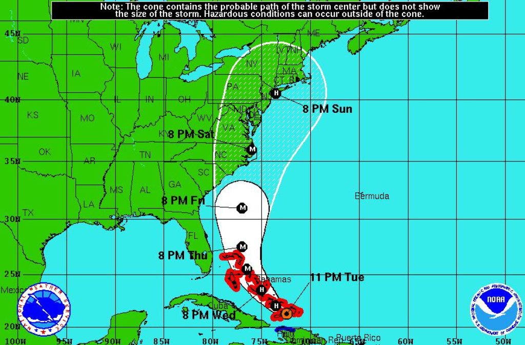
Downgraded to a Category 1 storm Tuesday afternoon, Hurricane Irene is expected to pick up speed and strength today as it turns toward the East Coast, according to the National Hurricane Center in Miami.
Irene lumbered into the Bahamas at 9 mph Tuesday night and is expected to clear the islands tonight before taking a turn toward the north, according to the National Hurricane Center. Forecasters warn that Irene could grow into a major hurricane tonight or Wednesday.
The storm's projected path was adjusted steadily to the east throughout the day Tuesday.
Find out what's happening in Arbutuswith free, real-time updates from Patch.
On Tuesday night, the National Hurricane Center reported that tropical-storm-force winds extended up to 205 miles from the center of the storm.
Irene is also packing a storm surge of up to 11 feet, a figure that is expected to grow by the time the storm makes landfall in the United States on Saturday.
Find out what's happening in Arbutuswith free, real-time updates from Patch.
Current forecast models from the National Hurricane Center suggest it may run aground in the Carolinas.
Some predicted tracks of Irene place the storm in or near Chesapeake Bay on Sunday.
Check back with Arbutus Patch for continuing coverage.
Get more local news delivered straight to your inbox. Sign up for free Patch newsletters and alerts.